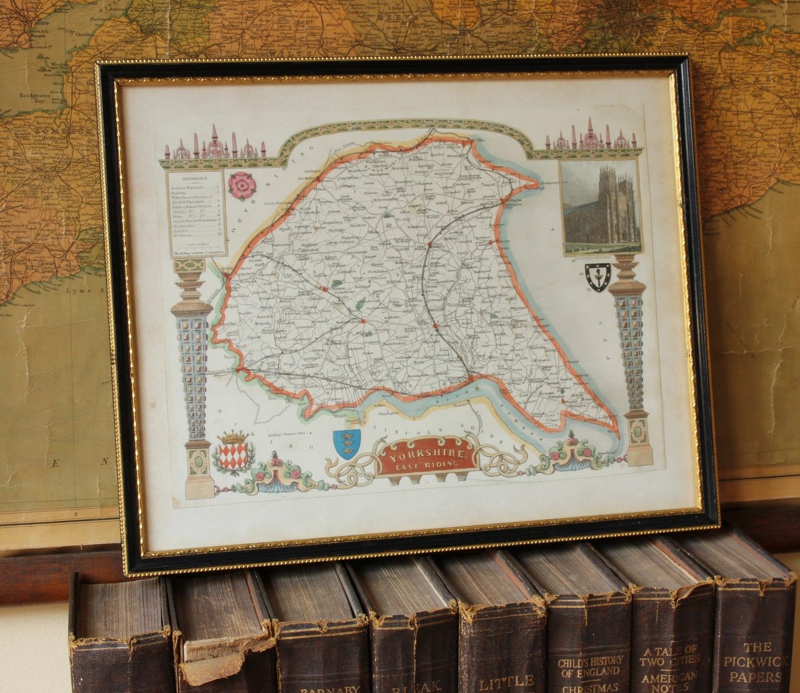
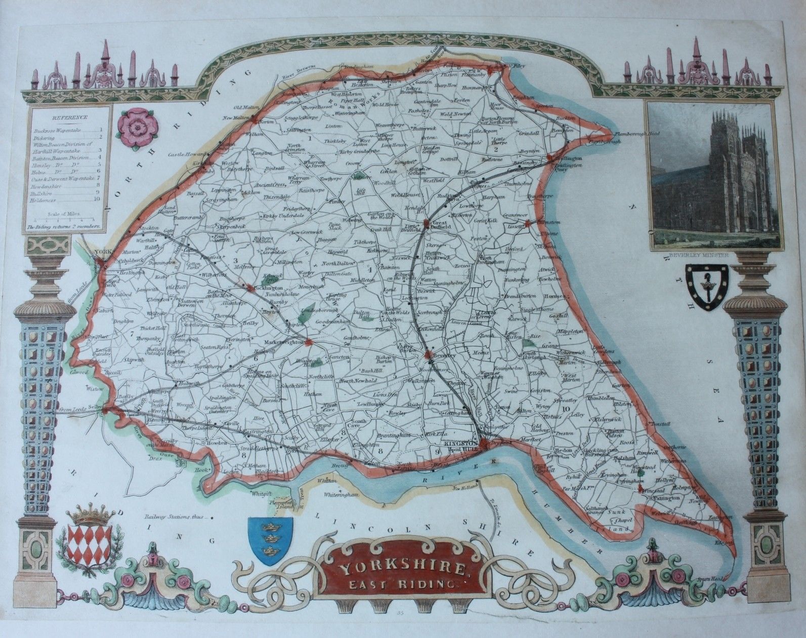
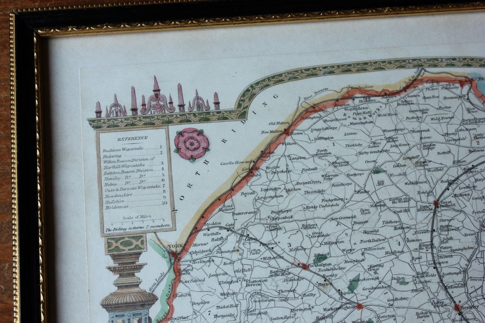
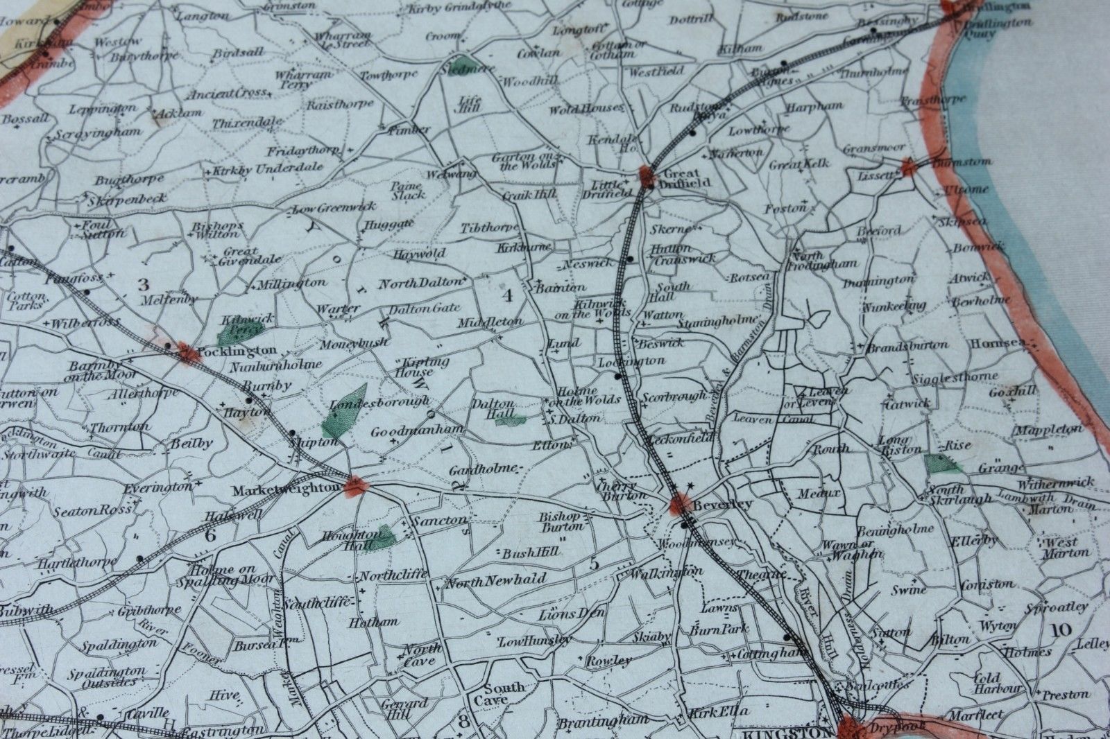
Map of Yorkshire. Hull, Beverley Minster, East Riding. MOULE c1840.
SOLD
Missed this item? Please contact us to add similar to your wanted list.
This interesting original antique map of Yorkshire that dates from c1840 would make a wonderful gift.
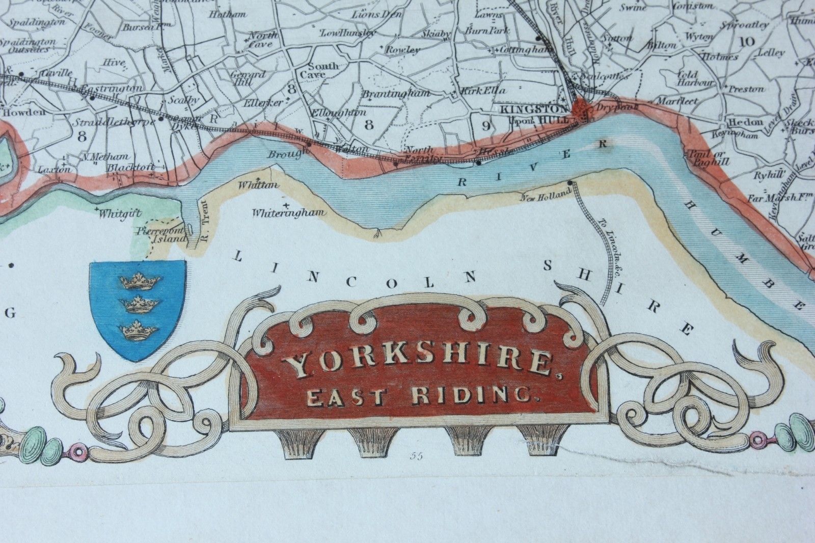
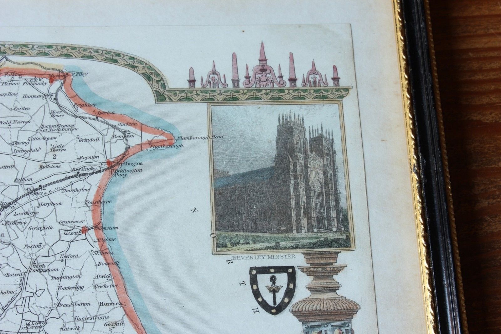
This genuine antique copper plate printed map is by Thomas Moule and includes Hull, Beverley, Great Driffield and a decorative vignette of Beverley Minster.
The map, which has some hand colouring, was published in London c1840.
Framed, glazed and ready to hang.
Frame size: 33 cm x 27 cm - 13" x 10 1/2" approx.
Printed area: 27.5 cm x 20.5 cm - 10 3/4" x 8" approx.
Condition: Scarce Genuine Antique map, which has some slight discolouration/staining and foxing. Please see pictures. Framed, glazed and ready to hang.
Free UK Delivery
Allow 3 - 5 working days for delivery. Express delivery can be arranged.
Can be shipped worldwide. Please contact us for a quote.