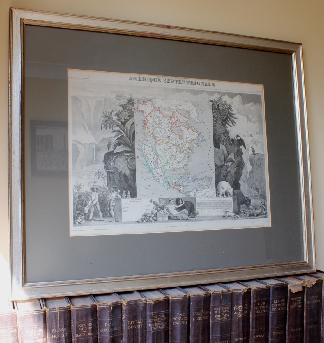
Antique North America Map Amerique Septentrionale Atlas Universel Illustre c1845.
£225.00
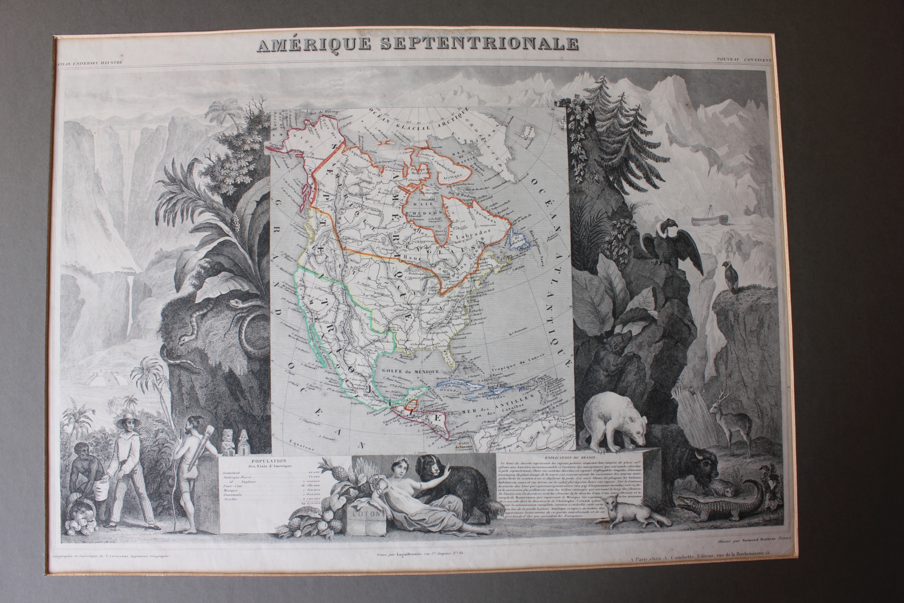
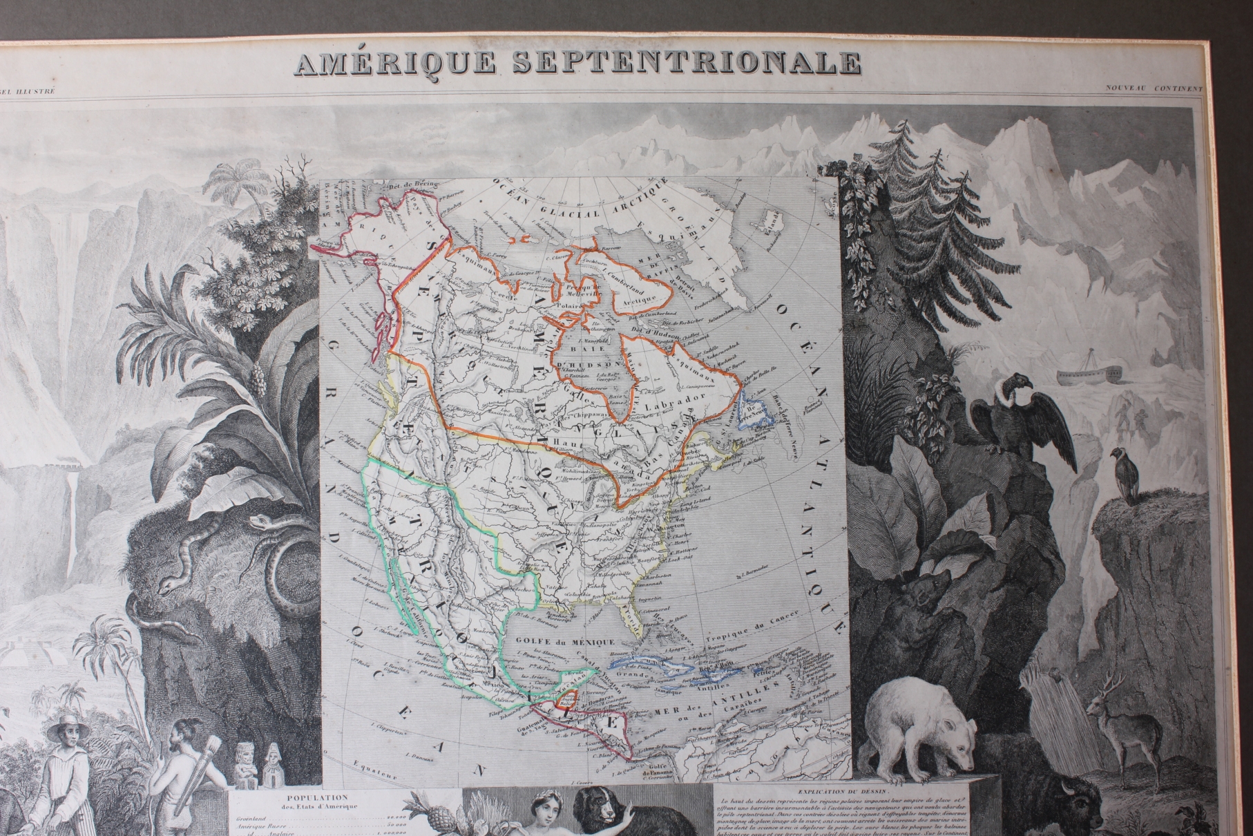
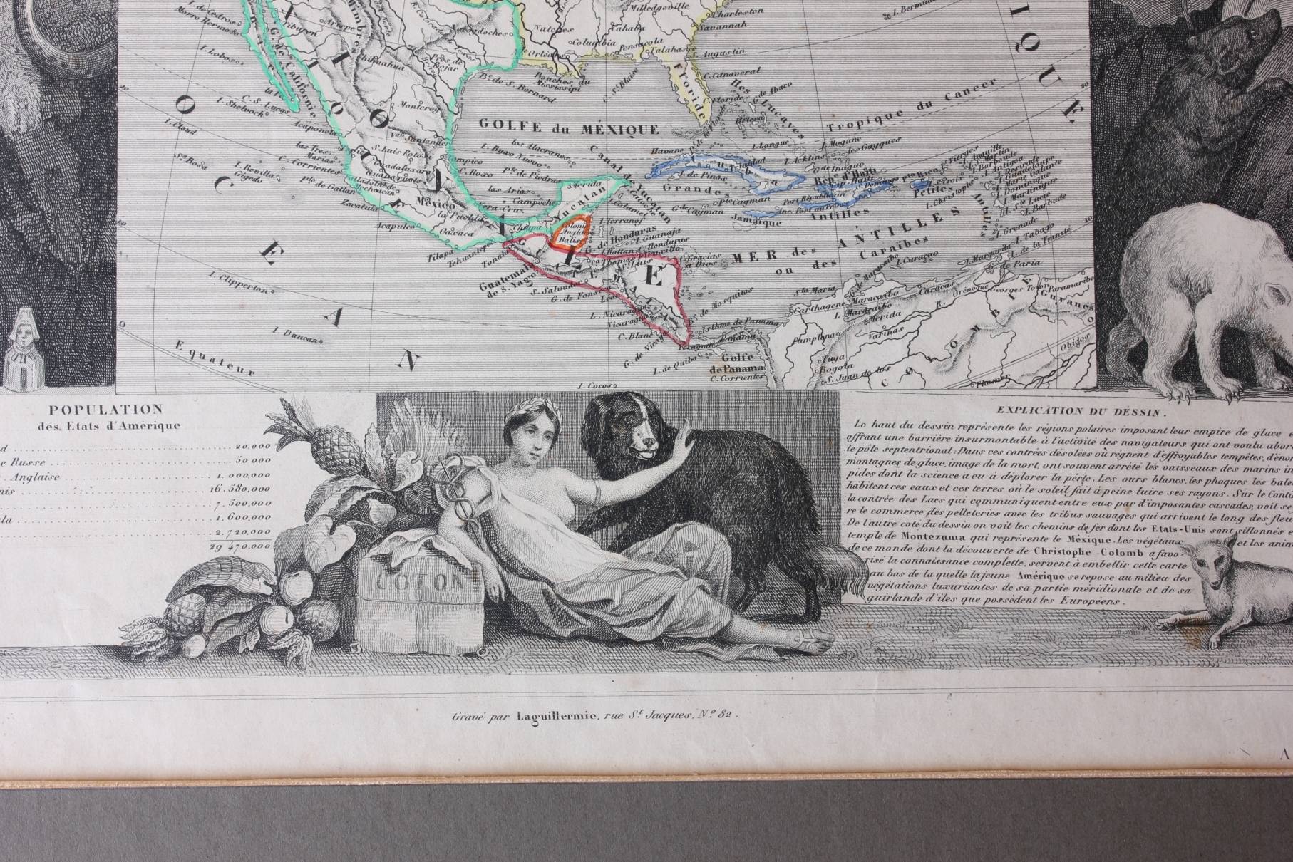
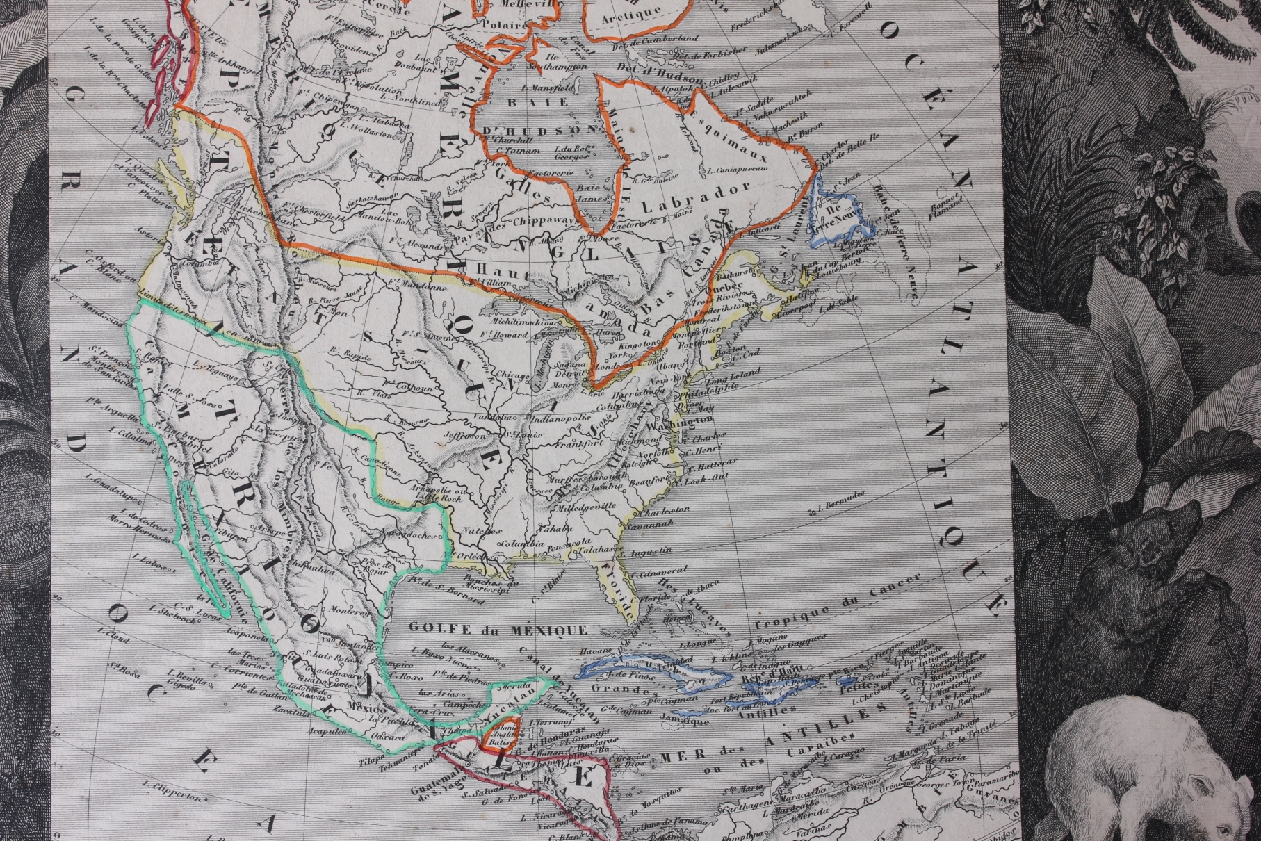
This genuine, interesting and scarce antique map of North America (Amerique Septentrionale) with original hand colouring is by Victor Levasseur and is from the Atlas Universel Illustre which was published in Paris in c1845 and is one of the finest decorative atlases of the 19th century.
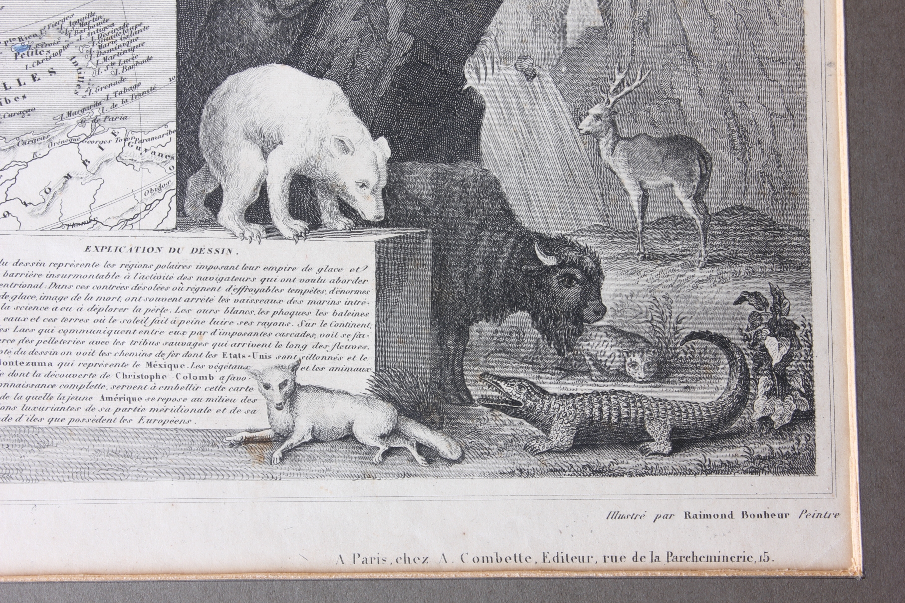
This fascinating map is wonderfully decorated and depicts the American continent as it existed in 1845. The very ornate and detailed border depicts scenes with animals native to North America such as bison, alligators and bears. The chart at the bottom lists the population of each country. Despite the date, Texas is not named on the map or listed in the population table underneath.
An unusual, handsome and very informative map.
Framed and glazed.
Frame size: 66 cm (26") x 54 cm (21") approx.
Printed area: 44 cm (17") x 32 cm (12 1/2") approx.
Date: c1845
Condition: Scarce Genuine Antique map, some slight discolouration/staining and foxing. Slight creasing. Please see pictures. Framed, glazed and ready to hang.
Free UK Delivery
Allow 3 - 5 working days for delivery. Express delivery can be arranged.
Can be shipped worldwide. Please contact us for a quote.